Project Description
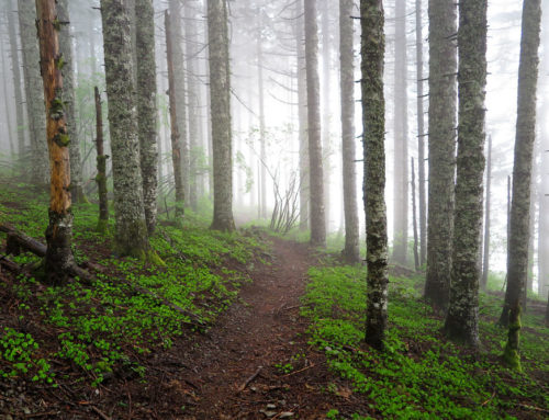
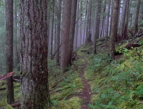
Siouxan Trail is one of the most scenic easy trails around.
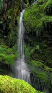
Unnamed Waterfall along the road to Siouxan Trailhead
It has waterfalls galore, bridges, lush foliage, trees, and follows the Siouxan Creek. The trail wanders along the creek and has ups and downs, but no extremes. I would put it into the easy category. Some of the side trail off the Siouxan Trail are very difficult – like the Horseshoe Ridge Trail.
This is a very popular trail during peak hiking season. It has several creek-side camp site all along the trail. Popular for backpacking and camping for several days. The Siouxan Creek has many different waterfalls – some named and some not. Pictured here are the ones you will find in the first 5 miles of this trail. The named ones are Horseshoe Creek Falls, Siouxan Falls, 14 Mile Falls. There are several that are either unnamed or I did not find the name for them. The Chinook Trail bridge is closed for repairs so any of the “loop” trails described on the Internet require wading the creek – something that would not be too smart this time of year.
The actual trail is easy to find and well marked. It is mostly dirt and tree needles. Some areas get muddy after a rain, and some areas are a little rocky – but not too bad. This is an out and back trail that is about 9 miles long. You can turn around at any point. Overall this is a great place to take a family hiking.
Driving Directions
Via I-5:
Drive I-5 north to Exit 11 for Battle Ground and Highway 502E.
Keep right after 0.2 miles (bearing left takes you to a Rest Area) and, in another 0.6 miles, merge right with Highway 502E for Battle Ground.
Drive 5.9 miles into Battle Ground, and turn left at a traffic light for Highway 503N, Amboy, and Yacolt.
Via I-205:
Drive I-205 North to Exits 30B and 30C for Highway 500E.
Keep right then left after exiting, taking Exit 30B and driving 0.7 miles to join Highway 500E.
In 0.7 miles, come to the traffic light at the junction with 4th Plain Boulevard. Continue straight here on Highway 503N for Battle Ground.
After 7.9 miles, come to the intersection with Main Street in Battle Ground. Go straight here.
From the 503N-Main Street intersection in Battle Ground:
Drive 12.6 miles to Amboy.
Bear right on 399th Street and drive 0.3 miles to a sharp turn in Amboy.
Go left here, and then after 0.2 miles, make another sharp turn right, keeping on 503N for Cougar and Chelatchie (This is also NE Chelatchie Road).
After 4.0 miles, turn right on NE Healy Road in Chelatchie, just after passing the Mt. St. Helens National Volcanic Monument Headquarters.
Drive 5.2 miles (After 2.4 miles, the road becomes FR 54; once the road enters the forest the pavement is often broken and/or sunken – drive with care!), and come to a fork.
Keep right here and at the next junction, driving another 4.0 miles to turn left (uphill) on FR 57.
Go 1.3 miles to a junction, and make a sharp left here on FR 5701.
Drive another 3.7 miles downhill on a narrow, rough, mostly paved road to the Siouxon Trailhead.