Project Description
This hike has been on my list for a while now – finally had the chance to take the adventure. This trail starts from a parking area that shares the Sherrard Point trail – a very short trail that goes to a scenic lookout.
Sherrad Point

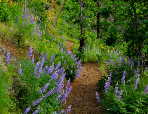
Possibly a Shooting Star Flower – not sure. The trail was covered with these.
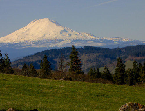
This is a short uphill climb to a great lookout point. From the top you can see Mt. St. Helens, Mt. Adams, Mt. Rainier, Mt. Hood, and Jefferson. Today was very hazy and somewhat cloudy – so we only saw a few. This also appears to be a hang-out spot for teens at sunset.
Larch Mountain Crater Trail
This is a loop trail that is about 6 miles long. From the parking area the trail heads down for quite a while. The Larch Mountain Trail, #441, starts at the southwest corner of the parking lot. You’ll start by passing through an old, mostly abandoned campground. The trail then drops down somewhat steeply through a dense, view blocking forest. You’ll cross a closed road and a large campsite area. Two miles down, you’ll turn right on to the Multnomah Creek Way Trail #444.
The path continues dropping down to a log bridge over Multnomah Creek 2/10 of a mile from the trail junction. Just across the bridge, you’ll find Multnomah Creek Spur Trail #446. Stay to the right and continue on Trail #444 traveling upstream. The trail, now deep in the old crater, passes through a marshy meadow filled with shooting stars and marsh marigolds in the spring. This was once a lake, but centuries of natural sediments have filled it. Sherrard Point towers over this area. The trail switchbacks up the crater wall to an old logging railroad grade. The trail follows the relatively level abandoned grade for about a mile to a junction with Oneonta Trail #424. Turn right at this junction and make your way back to the road. Once on the road head uphill to your car.
We found some wonderful white wildflowers – they might be shooting stars – I am not sure. There are a few areas where the trail is very rocky (looks like old creek bed) and the trail is hard to follow. It would be easy to get “off trail” in one of these areas. For the most part this was an easy trail. While we were in the actual crater it was easy to see that this was an old lake. It is very marshy now with lots of different vegetation. There were some great views of Mt. St. Helens in a few areas – would be great sunset shots on the right day.
We stopped in Corbett on the way home for a great view of Vista House.
Driving Directions
Drive from Portland or Corbett eastward on the Historic Columbia River Highway to just past the Women’s Forum Overlook. At mile 22.9, turn right on Larch Mountain Road and drive 14 miles to the trailhead at the end of the road.
This trailhead is closed most of the winter and spring because of snow (it typically opens at the end of June or very beginning of July) and the road is gated 4 miles down the mountain. The road is plowed to the gate in winter, which means it’s possible to park at the gate and ski (or snowshoe) the road up to the summit.